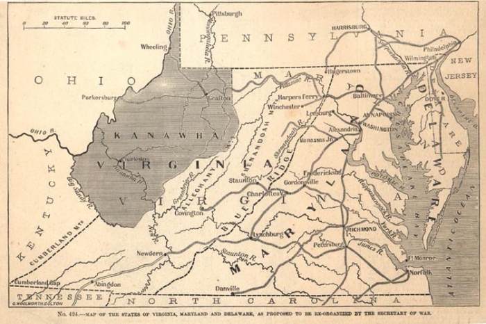
Here’s another map from Strange Maps (one of my favorite places on the internet). It shows:
the seceding part of Virginia as Kanawha (as yet still without its eastern panhandle and some of its southeastern territory). It is a Map of the States of Virginia, Maryland and Delaware, as Proposed To Be Re-Organised by the Secretary of War. In this proposal, Delaware expands to include all of the Delmarva peninsula, including its Virginian part in the south, but more importantly, Maryland annexes all of Virginia between the Blue Ridge Mountains and the sea. As a consolation prize, Virginia gets Maryland’s western protrusion, making Hagerstown a Virginian city. But then there’s Kanawha seceding, leaving what remains of Virginia proper to look like an unseemly leftover.
Follow the link for more of the historical context.
